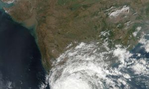
 NASA satellite data provided a look at the cloud cover and rainfall rates within Tropical Cyclone Vardah. The Global Precipitation Measurement mission or GPM core satellite measured rainfall rates as Vardah was headed for landfall. After landfall, NASA-NOAA’s Suomi NPP satellite captured an image of the storm’s cloud cover as it weakened to a remnant low pressure area over southern India.
Tag: cyclone
Half a million flee as Cyclone Roanu hits Bangladesh
 Cyclone Roanu battered the coast of southern Bangladesh on Saturday, forcing half a million people to flee their homes and leaving 23 people dead in floods and rain-triggered landslides.
Authorities in low-lying Bangladesh took more than 500,000 people into shelters as the cyclone made landfall just after midday local time (0600 GMT), packing winds as strong as 88km per hour. Continue reading…